Hartley Gardens Supplementary Planning Document
Introduction
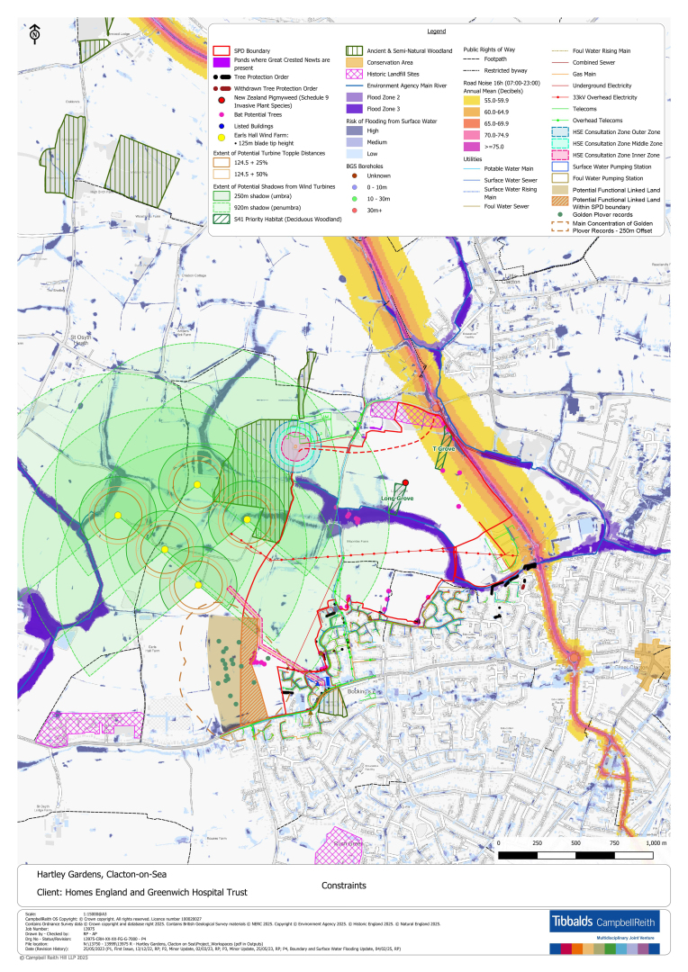
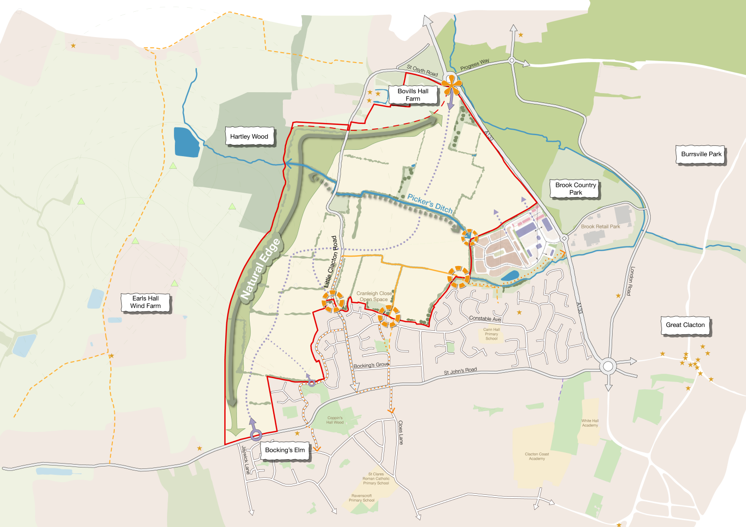
2.1. The purpose of this section is to provide an overview of the main technical considerations including an assessment of the Site, the main constraints, present the key opportunities and influences underpinning the Vision, Objectives, and Spatial Framework for the Site. These have been identified as part of a baseline assessment and review of documentation and were presented as part of Stage 1 Evidence Gathering community engagement in 2023.
2.2. The Plan opposite illustrates the combined constraints and influences, which are then summarised in turn in the sub-sections following.
Local Context
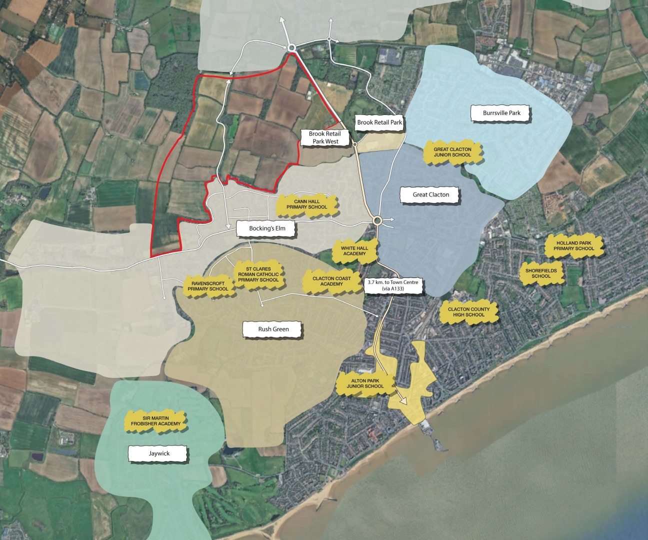
2.3. The Site is influenced by its relationship to adjacent neighbourhoods and local amenities.
Bocking's Elm
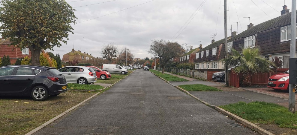
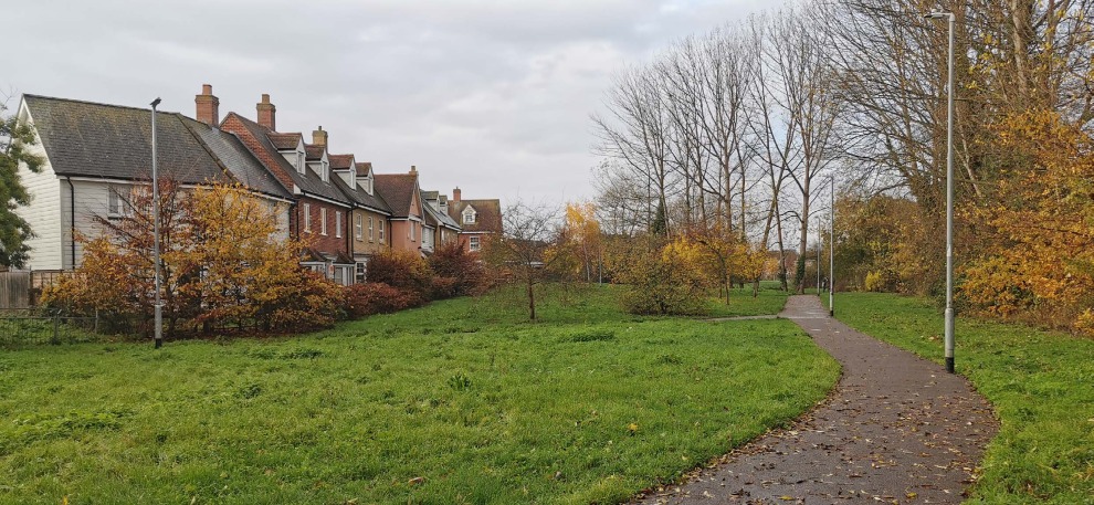
2.4. A residential suburb of Clacton-on-Sea, Bocking's Elm, located directly to the south of the Site, benefits from a variety of open spaces serving local residents, creating core focal points within the neighbourhood. The structure of Bocking's Elm is predominantly cul-de-sac residential roads of two storey homes with the principal streets of Constable Avenue and Bocking's Grove forming the main residential roads serving the neighbourhood.
Brook Park West
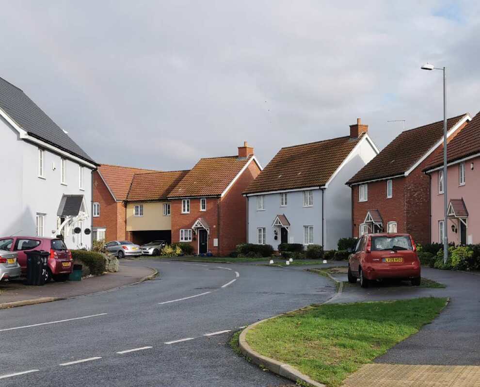
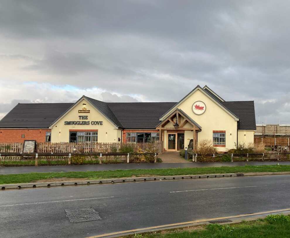
2.5. Brook Park West is located directly to the east of the Site. It is a retail-led, mixed-use development comprising 200 homes, business units, a food store, hotel, family public house, and drive-thru restaurants. The layout is set to be a simple structure, with homes overlooking open space and integrating pedestrian and cycle movement into the wider area.
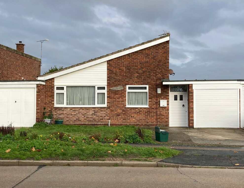
Great Clacton
2.6. A residential suburb of Clacton-on-Sea, Great Clacton located to the east of the Site, and is a diverse area with a range of street types, from standard block types to cul-de-sacs. Boundary treatments, setbacks, orientation, and the building lines all vary, creating assorted streets and patterns. Similarly, the house types range from single-storey bungalows to large twostorey homes, varying in architectural quality and style. There are also very few similarities in materials and details, although redbrick and clay tiles are common in this neighbourhood.
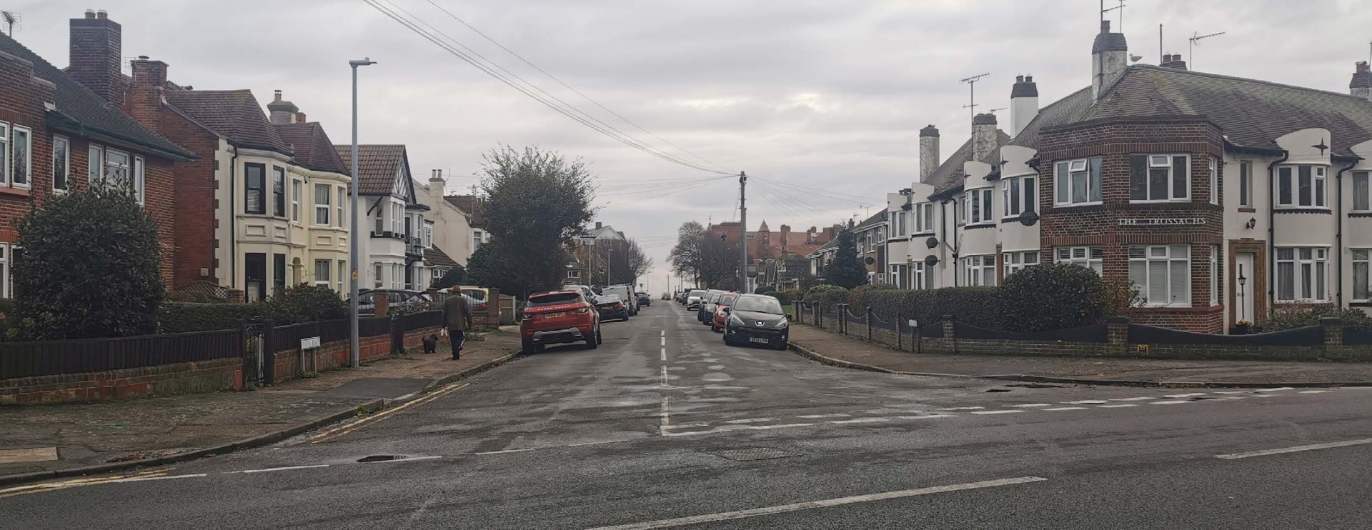
St Osyth Road West
2.7. This area, located to the north of the Site and south of Little Clacton, comprises 22 large detached residential homes with substantial setbacks, private driveways, and extensive linear rear gardens. A mix of two-storey and single-storey homes in a range of materials and styles. There is no distinctive character here although one common characteristic is the use of dual pitched roof forms and red clay tiles.
Little Clacton
2.8. Little Clacton, located directly to the north of the Site, comprises a small green, two pubs, a holiday park, as well as a primary school and several small shops. Predominantly two-storey homes front onto residential roads, with generous setbacks, accommodating onplot car parking. Smaller residential roads lead to cul-de-sacs of single-storey bungalows.
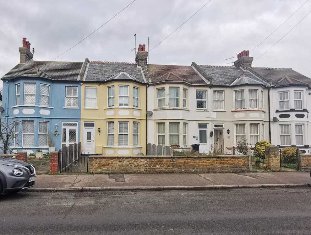
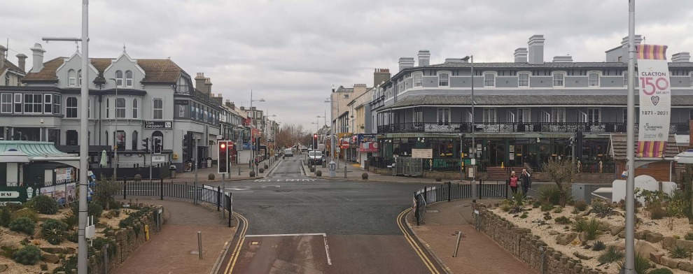
Clacton-on-Sea Town Centre and seafront neighbourhoods
2.9. Clacton Town Centre is focussed around the High Street, Station Road and Pier Avenue, with the pedestrianised area to the south of where Station Road meets Pier Avenue providing a meeting node.
2.10. The seafront residential area is structured by neighbourhood perimeter blocks with a regular and connected network between residential streets and the principal streets. The regular street system continues from Marine Parade West to the Town Centre and Marine Parade East. Redbrick and red clay tiles are common in this neighbourhood.
Landscape, ecology and biodiversity
Landscape character
2.11. At the District level, the Site is in Landscape Character Area (LCA) 8B Clacton and the Sokens Clay Plateau (Tendring District Landscape Character Assessment Vol 1 Nov 2001). The overall landscape strategy of the LCA is 'to strengthen and enhance the character of the individual villages and the rural wooded character of the landscape.' Landscape enhancements within the LCA would include increasing the extent of native deciduous woodland, conserving hedgerows, and considering opportunities for meadow creation.
2.12. The historic settlement pattern includes small villages set around greens and can provide a reference for new residential areas. The landscape character assessment notes that there are important views across the agricultural hinterland and towards landmarks such as churches.
Key landscape features
2.13. Key landscape features include:
- Pickers Ditch, Priority Woodlands and the internal hedgerow field structure with some feature trees and vegetative screening along the A133.
- The boundary to Little Clacton Road and St John's Road.
- The northern part of the Site provides separation between Clacton-on-Sea and Little Clacton.
- Key views into the Site are identified from St John's Road and the existing residential edge of Clacton-on-Sea.
- Hartley Wood.
- Earls Hall wind turbines.
- Existing PRoW.
Ecology and biodiversity
2.14. An ecology assessment has confirmed that there are a number of ecological constraints to the Site.
2.15. Priority Habitats confirmed present through the Assessment include:
- T Grove and Long Grove Woodlands - these woodland parcels should be retained where possible with a minimum 15m buffer and any losses must be compensated.
- Hedgerows - should be retained/enhanced where possible. Loss of any priority hedgerows will require compensation.
2.16. Great Crested Newts (GCN) - present to the north of the Site. Mitigation will require enhancement of nearby habitats within open spaces to create additional ponds and a structurally diverse habitat (longer grass/scrub/ woodland) connecting these new and existing ponds. Amphibian underpasses will need to be considered along with Amphibian friendly drainage features on roads within 250m of confirmed GCN ponds.
2.17. Barbastelle Bats – commuting along hedgerows in the south-west of the Site and commuting from Hartley Wood from the west to the Site. Dark corridors will need to be considered close to smaller areas of woodland.
2.18. The development should maximise biodiversity net gain and protect or enhance existing biodiverse features of the Site and surrounding area. Opportunities for biodiversity enhancements in built up areas should also be optimised.
2.19. A 10% uplift in biodiversity net gain is mandatory2 for all new developments of 10 homes or more. As a general guide, to achieve 10% net gain where predominantly arable habitat is lost, there will need to be public open space provision that includes habitat enhancements. Retaining and enhancing (where possible) medium/high distinctiveness habitats that would likely include grassland, woodland, trees, scrub, ponds, ditches, and hedgerows, would be advantageous.
Heritage and archaeology
Designations
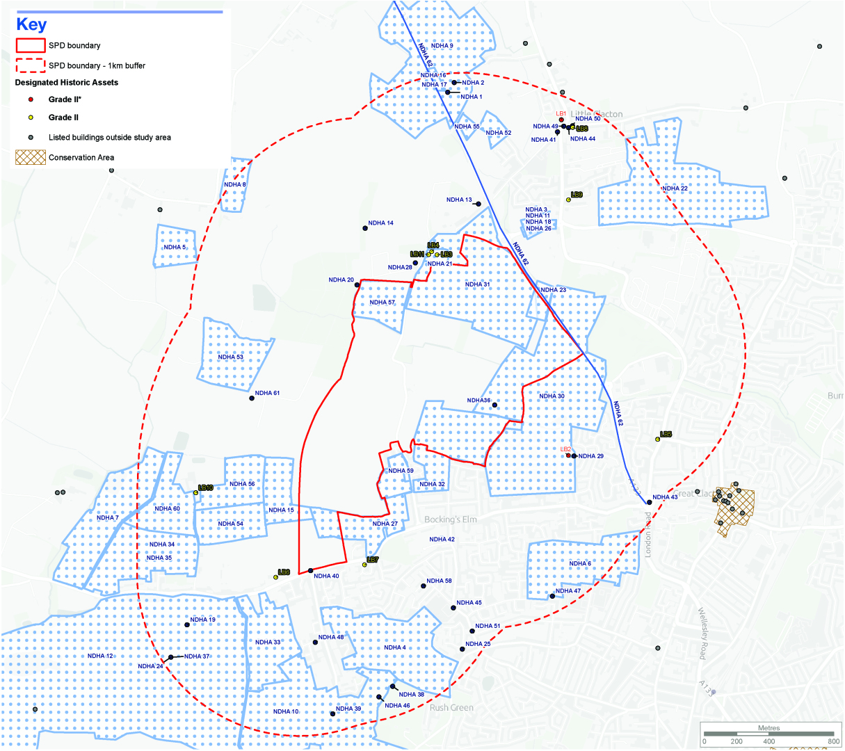
2.20. There are no world heritage sites, scheduled monuments, conservation areas, registered parks and gardens, or registered battlefields on or adjacent to the Site. There are eleven designated heritage assets within the 1km study area, comprising two Grade II* Listed Buildings and nine Grade II Listed Buildings. The closest heritage asset is Bovill's Hall directly north of the Site:
| National Heritage List for England Reference | Name | Description | Grade | Significance |
|---|---|---|---|---|
| National | ||||
| 1165915 | Church of St James approx. 780m to the north-east | Flint and rubble 12th-century parish church with 14th-century nave, south porch, and 15th-century bell turret, extensively restored in the 19th century. | II* | High |
| 1111549 | Cann Hall approx. 320m to the south-east | Timber-framed house circa 1512, built for St Osyth's Priory, with some 18th-century alterations; refenestrated in 20th century. | II* | High |
| National Heritage List for England Reference | Name | Description | Grade | Significance |
|---|---|---|---|---|
| Regional | ||||
| 1111510 | Bovill's Hall approx. 60m to the north | A timber framed and rough rendered house from the 15th or 16th century of possibly earlier origin with later alterations and additions. | II | Moderate |
| 1337126 | The Robin Hood approx. 700m to the east | Timber-framed and plastered 17th-century public house with later additions and alterations. | II | Moderate |
| 1309179 | Barn approx. 30m north-west of Bovill’s Hall | Timber framed and weatherboarded Barn from the 16th century with later re-roof. | II | Moderate |
| 1111511 | Pig sties approx. 50m north-west of Bovill Hall | Red brick pair of pig sties from the 19th century. | II | Moderate |
| 1337149 | Bluehouse Farmhouse adjacent to east of Clacton Garden Centre approx. 115m to the south-east | Timber framed with red brick faced house of 17th century origin with later alterations and additions. | II | Moderate |
| 1111509 | Westbourn Cottage approx. 840m to the north-east | Oak timber-framed and plastered 17th-century cottage with thatched roof and 18th-century alterations. | II | Moderate |
| 1309075 | House believed to be known as Earls Hall Lodge approx. 640m to the west | Plastered brick early 19th-century house with hipped grey slate roof and later additions. | II | Moderate |
| 1111522 | Duchess Farmhouse approx. 145m to the south-west | Timber framed painted brick faced 17th century farmhouse with 18th century alterations. | II | Moderate |
| 1165889 | Stone Hall approx. 480m to the north-east | Timber framed 17th century house with later alterations and rear additions. | II | Moderate |
Historic landscape
2.21. Analysis of available historic mapping shows that there are historic hedgerows that pre-date 1845 that survive on Site and are therefore considered important.
2.22. Most of the Site is made of the 'Pre 18th century 'Irregular' Enclosure Historic Landscape Characterisation (HLC)' type forms. This HLC type is common within the country comprising irregular enclosures varying in size and shape, forming both arable and pasture. They are probably the result of piecemeal enclosure and may originate from the medieval period or earlier. This HLC type has been affected by boundary loss resulting in hybrid and palimpsest, with edges that may have several periods of origin. The surviving edges of these fields are of historic importance.
2.23. The Site also has surviving Ancient Woodland. In Essex, the HLC states that these also include 'traditional wood-pasture, such as seen at Hatfield Forest, where single or small groups of pollarded trees occur in pasture alongside small coppice-with-standards managed woodlands.' This rare HLC type can preserve features such as an uneven land surface that pre-date the woodland, such as prehistoric earthworks or medieval cultivation ridges where woodland has regenerated.
Archaeology
2.24. There are a large number of nondesignated heritage assets with archaeological interest within 500m of the Site, providing evidence of human activity within the Site for the majority of periods from prehistoric to modern. Therefore, there is a generally moderate to high potential for archaeological remains to survive on Site for all periods. Analysis of the aerial photography suggests that there is a likelihood of post-medieval field boundaries and other activity to survive on Site. Cropmarks of linear features are clearly visible in the fields within the southern extent of the Site. The Historic Environments Records also records previously excavated cropmarks which have revealed evidence of prehistoric enclosures.
2.25. Excavations in advance of the construction of the Clacton - Weeley bypass recovered a series of prehistoric ditches and a pit at the western end of the Site. A moat associated with Bovill's Hall is also recorded within the Site and is visible on the first edition Ordnance Survey map. Aerial photography does not show any evidence of this surviving, although it may be buried or obscured.
2.26. In line with the National Planning Policy Framework and LPS2 Policy, a historic environment desk-based assessment of the Site should be undertaken, prior to any planning application being determined. The results of this assessment should be further informed and/or complimented by a programme of archaeological evaluation, both invasive and non-invasive, that should be undertaken prior to any planning application being determined. Appropriate mitigation may be required depending on the outcome of that evaluation. Any such mitigation may require the physical preservation of any significant archaeological deposits identified within the Site.
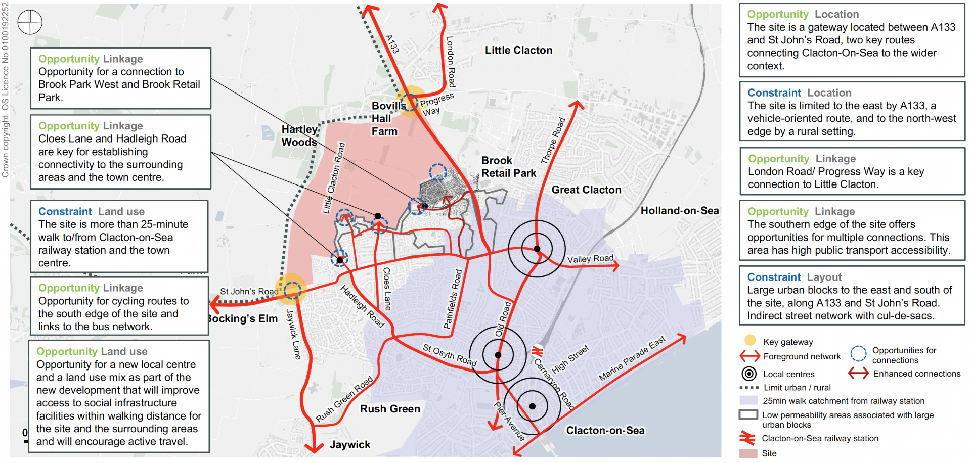
Access and movement
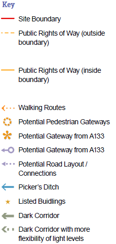
Walking and cycling
2.27. Existing pedestrian infrastructure in the southern vicinity of the Site is of mixed quality. Footpaths along St John's Road are provided and generally smooth, with dropped kerbs provided at a majority of crossing points. It is notable that there are relatively few formal pedestrian crossings. Footpaths on Legerton Drive and Constable Avenue are wide and smooth. There is no pedestrian infrastructure along Little Clacton Road or the A133. The eastern edges of the Site abut the A133 and are obstructed by dense vegetation.
2.28. There is no dedicated cycle infrastructure or facilities in the immediate vicinity of the Site. However given the range of residential avenues with appropriate widths, these are accessible for cyclists. For the purposes of extending cycle routes into the Site, the most notable opportunities are onto St John's Road, Legerton Drive, Little Clacton Road, Cranleigh Close, and connections along Pickers Ditch to the south of Brook Park West.
Public transport
2.29. The Site is currently served by seven bus services that pass within a maximum walking distance of 640m (an eight-minute walk at 4.8kph). The services include routes 3, 6, 6A/B, 7, 74, and 135. The closest bus stops to the Site are on Legerton Drive, approximately 140 metres from the south edge of the Site. Due to the size and extent of the Site, bus services will need to enter the Site in order to provide a high-quality service that can act as a genuine alternative to car use. There are numerous opportunities to improve walking connections, to existing PROW's, St John's Road, and along Pickers Ditch towards the A133.
2.30. The south of the Site is located 3.3km to the north of Clacton-on-Sea Railway Station, with bus routes 6/A/B, 7, and 135 stopping at the Railway Station Bus Stop (Stop 3). Clactonon- Sea Railway Station is served by Greater Anglia services to London Liverpool Street, which depart on an approximately hourly basis. Thorpe-le-Soken Station is 4.6km to the north-east of the Site and is served by Greater Anglia services to London Liverpool Street, Colchester, Walton-on-the-Naze, and Clactonon- Sea. All of these services depart on an approximately hourly basis.
Vehicles
2.31. The key influences with regard to the external road network relate to the capacity and nature of:
- St John's Road: largely residential road running east/west to the south of the Site with narrow lanes running in each direction. It has no on-street parking.
- A133, St Johns Road/London Road Roundabout and Progress Way/St Osyth Road Roundabout: north/south arterial road running largely adjacent to the eastern boundary of the Site and connecting to the town centre. It has one lane going in each direction.
- Legerton Drive: newly-built road north of St John's Road, connecting with Little Clacton Road, and featuring numerous inlets between properties.
- Little Clacton Road: north/south road running through the Site. It is rural and consistently lined with hedgerows and vegetation which limit opportunities for widening.
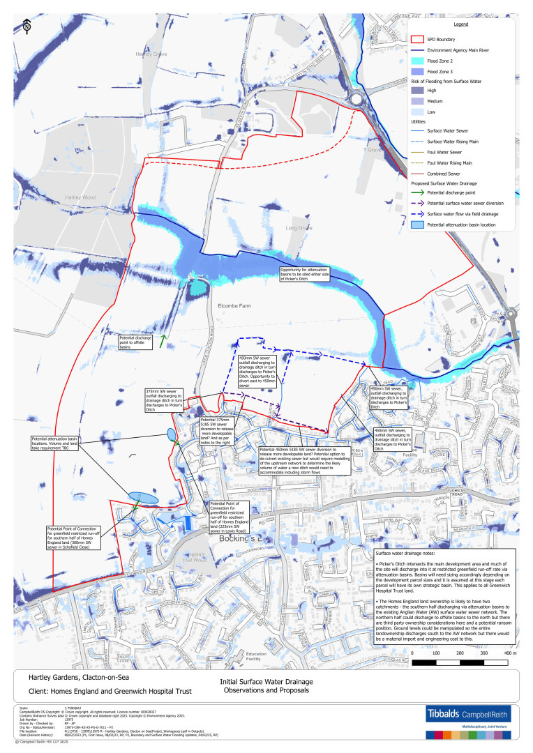
Flooding and drainage
2.32. Pickers Ditch - an Environment Agency Main River - bisects the Site in a broadly west/ east direction. Whilst designated a Main River, it is a vegetated/overgrown ditch approximately 1m deep and does not appear to be regularly maintained. It forms part of the Holland Brook catchment which eventually discharges to the North Sea. There is localised flood plain (Zones 2/3) and surface water flooding associated with the Ditch. There are also several field ditches within the Site which convey surface water to Pickers Ditch and a number of small culverts in variable condition.
2.33. The majority of the Site is underlain by impermeable clay and therefore infiltration drainage is not viable as the main means of water conveyance. Instead, interconnected ponds and swales should comprise the sustainable urban drainage strategy (SuDS), discharging water at restricted greenfield rate into Pickers Ditch. Localised infiltration may be feasible in the very south-west of the Site associated with the sands and gravels.
2.34. Planning applications will need to include a drainage strategy detailing the foul and surface water drainage strategy for the Site or part of the Site. When considering the drainage strategy, they should consider local standards as well as local policy, national policy, and standards.
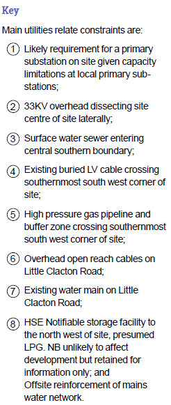
Utilities
2.35. An assessment of the Site has identified key utilities and infrastructure considerations.
2.36. Overhead electricity lines at 33kV and 11kV cross the Site and will require diversion or undergrounding. This will involve consultation with UK Power Networks (UKPN) to agree on an appropriate solution.
2.37. A high-pressure gas pipeline crosses the south-west corner of the Site, sterilising part of this area for development and may require a 15m easement strip either side of the pipeline. Consultation with Cadent Gas Ltd will be required for works within proximity to the pipeline and to confirm the easement strip. The pipeline will remain in situ, and its presence must be fully accounted for in any development proposals.
2.38. A 10-inch water main runs along Little Clacton Road and will also remain in situ. While the main is not expected to significantly constrain development, a section where it diverges from the road alignment will require consideration when preparing planning applications.
2.39. Planning applications will include a utilities statement setting out how the development proposal has incorporated the existing and proposed utilities into the Site layout/masterplan. Where possible, utilities should be underground and not overhead.
Site Opportunities
2.40. Responding to the technical Site constraints and influences in relation to existing landscape, land uses, and key connections between the Site and existing communities, the following key opportunities have been identified:
- Integrated natural edge and landscape network: Create a diverse and well-connected landscape network that enhances and retains mature landscape features such as hedgerows, woodlands, and Pickers Ditch. Structuring the Spatial Framework, strengthening green corridors, and providing rich open spaces with extensive walking and cycling routes. Opportunities include opening up Pickers Ditch, removing culverts where appropriate, and preserving the area's natural character.
- Biodiversity Net Gain (BNG) and nature conservation: Prioritise biodiversity net gain through the retention and enhancement of habitats with the highest conservation value, including Pickers Ditch, T Grove, and Long Grove. Leverage these opportunities to secure "Building with Nature" accreditation and embed blue and green infrastructure strategies into the design.
- Sustainable and integrated movement strategy: Develop a comprehensive movement strategy that prioritises active transport. Ensure safe, continuous, and well-integrated walking and cycling routes that connect new and existing communities while protecting and enhancing PROW's.
- Heritage and landscape setting: Preserve and enhance the setting of listed buildings, buildings to be retained, and other heritage assets. Maintain a sensitive landscape gap to Little Clacton to respect its character and context.
- Gateway to Clacton-on-Sea: Establish the Site as a strategic gateway into Clacton-on- Sea, reflecting its position and importance in the plan-making process and creating a welcoming entry point into the town.
2 Under Schedule 7A of the Town and Country Planning Act 1990 (as inserted by Schedule 14 of the Environment Act 2021).